 Queenstown City Guide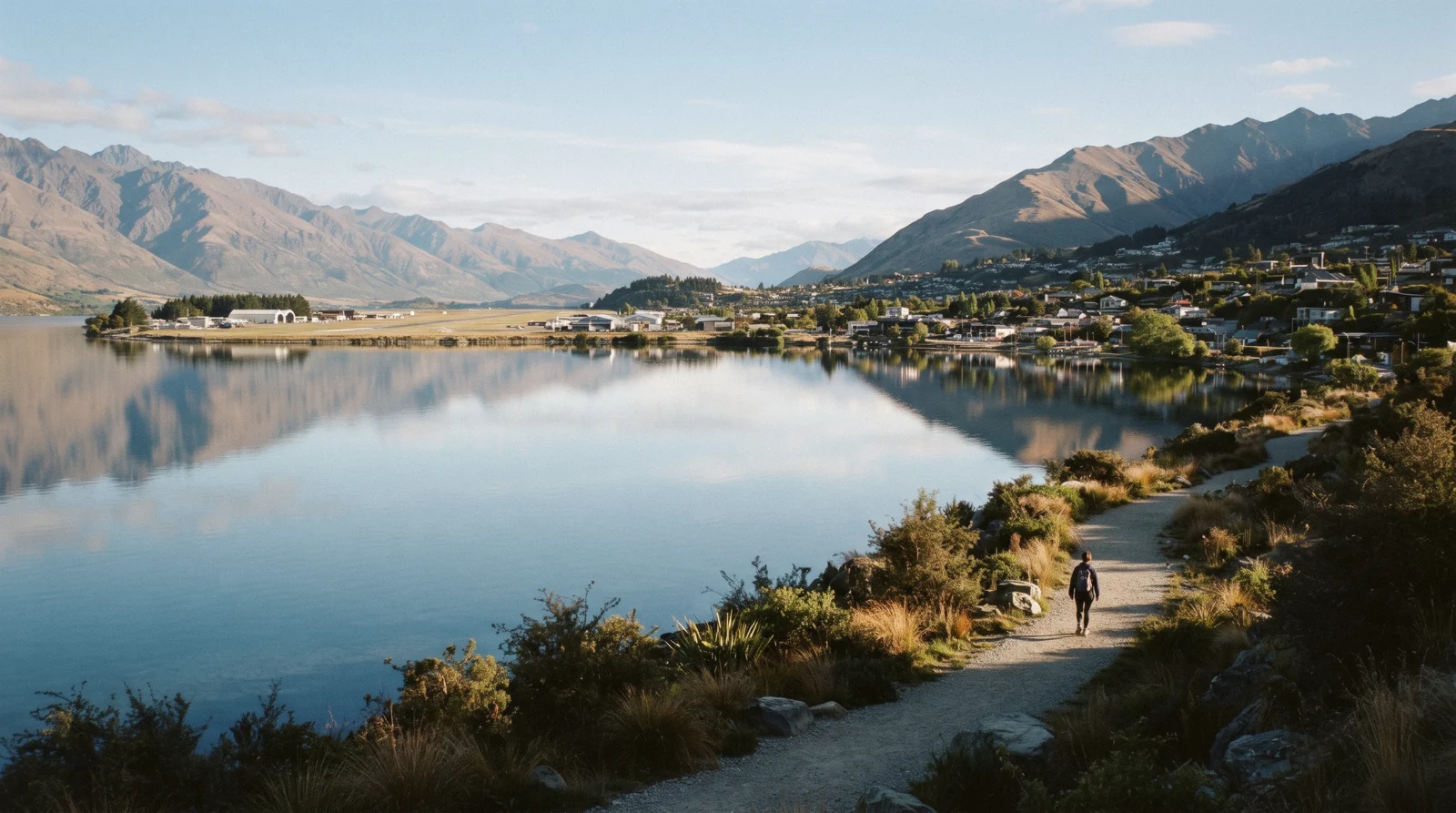
Queenstown Suburbs: How the Basin Fits Together
The Queenstown suburbs are easier to hold in your head once you see the shape they sit in: one lake arm, seven kilometres long, with the old town at the closed western end, the airport and the flats at the open eastern end, a peninsula filling the middle, and a single hillside road climbing away to the west. Almost everything a visitor books happens inside that shape, and five bus routes and one passenger ferry connect the whole of it. This page, part of the front page of this Queenstown, New Zealand guide, is the geography: what each area is, what it is not, which route reaches it and in how many scheduled minutes, and which ones stop working the moment you give up the car. What a bed costs in each of them is priced on where to stay in Queenstown; the fares and the timetables are on getting around Queenstown, which draws on the Otago Regional Council's own Queenstown bus and ferry timetables.
Quick answer The seven areas, which route reaches each, and which ones need a car
Wikipedia's own category for suburbs of Queenstown, New Zealand holds the names most visitors meet: the town centre, Frankton, Fernhill, Sunshine Bay and Kelvin Heights, with Arthurs Point up the Shotover and Arrowtown a separate town twenty-five scheduled bus minutes away. Five Orbus routes cover all of them for a flat $1.46 (NZ$2.50) adult fare with a Bee Card, and only one of the seven has no published running time at all.
Key takeaways
- The basin divides on one line: the western hillside road, which is Route 1 through the town centre out to Fernhill and Sunshine Bay, and the eastern flats, which is Route 1 again out to Frankton and the airport in thirteen scheduled minutes.
- One area is reached by boat as readily as by road. The peninsula across the Frankton Arm is twenty minutes to the Frankton hub on Route 3 and then a change, or a straight ferry crossing from the town-side wharf.
- Arthurs Point is the trap for a car-free stay: Route 4 stops there in both directions, but the council publishes no timing point for it, so no scheduled minutes exist. It is where the hot pools above the Shotover are, and it is a taxi home.
- If your question is really which area to book rather than where the areas are, the six rate bands and the trade-offs sit on where to stay in Queenstown, and a lake trip like the 1912 steamship leaves from the town side wherever you sleep.
The Seven Areas, and What Each One Actually Is
Seven areas compared on geography rather than price: what the place is, which Orbus route serves it, and the scheduled running time the council prints between its timing points. Where no timing point is published, this table says so instead of estimating.
| Area | What it is | Route | Scheduled minutes | Works without a car? |
|---|---|---|---|---|
| Queenstown town centre | The original 1860s township on Queenstown Bay: four shopping streets, the wharf, the gondola base and every operator check-in desk | Routes 1, 4 and 5 all call at the Stanley Street hub | You are already there | Yes, entirely on foot |
| Frankton | A separate settlement from 1863 that became a suburb: the airport, the hospital, three retail precincts and a marina, on the flats at the open end of the arm | Route 1 west into town, Route 2 east to Arrowtown | 13 into the town centre, 10 coming back | Yes, and it is the best-connected suburb |
| Fernhill | A hillside of houses and apartments on the lower slopes of Ben Lomond, reached by one road out of town | Route 1 | 12 from the Treetops stop | Yes, but the walk back is uphill the whole way |
| Sunshine Bay | The quiet end of the same road, past Fernhill; the western terminus of the network | Route 1 terminates here | Not published separately from Treetops | Yes, on the same buses |
| Kelvin Heights | A suburb on the isthmus of the Kelvin Peninsula, with the golf course on one side and Peninsula Hill on the other, looking back at the town | Route 3, plus the Orbus ferry from the Bayview stop | 20 to the Frankton hub, then a change | Yes by boat; by bus it is two rides |
| Arthurs Point | A small settlement above the Shotover Gorge, seven kilometres from town on the road to Coronet Peak, with the hot pools and a brewery | Route 4, which absorbed it in mid-2025 | None published — the council prints no timing point here | Awkwardly; there is no scheduled time to plan against |
| Arrowtown | Not a suburb at all: a separate gold-rush town with its own historic zone in the district plan | Route 4 from town, Route 2 from the Frankton hub | 25 from Stanley Street, 18 from Frankton | Yes, and it is a scheduled ride rather than a tour |
Running times are the scheduled minutes between timing points in the Otago Regional Council's September 2025 Queenstown timetable booklet, not door-to-door times from a particular address, and the current versions are on its Queenstown bus and ferry timetables page. Route 4 absorbed Arthurs Point from 30 June 2025 and the Frankton hub stops moved again in mid-2026, so read the council's bus alerts page before you rely on a connection. Read in Q3 2026.
The Seven Areas, Grouped and Numbered to the Map
Grouped by which side of the water they sit on, and numbered to the pins below. Each entry says what the area is for and what it will make you travel for; the four with the most searches have a guide of their own.
The western spine: town and the hillside
-
Queenstown town centre
The old township Everything on foot
Four streets, a bay and a bus hub. The Stanley Street interchange takes Routes 1, 4 and 5, the wharf is about five minutes from it, and the gondola base is at the top of Brecon Street. This is where the operators' check-in desks are, which is the practical reason a two-night visit stays here.
Tip: Council parking is free from 18:00 to 08:00 and all day on public holidays, so an evening in town costs nothing to park for.
-
Fernhill
Hillside suburb 12 scheduled minutes
Houses and apartment blocks on the lower slopes of Ben Lomond, east of Sunshine Bay, and by Wikipedia's own description accessible by a single road from the main township. Route 1 runs it every fifteen minutes or so through the day. Two Department of Conservation tracks start at or near the roundabout.
Tip: The bus in is twelve minutes; the road walk back out of town climbs the whole way, which is the part nobody mentions.
-
Sunshine Bay
The quiet end Route 1 terminus
The far end of the same road and the western terminus of the whole Orbus network — Route 1 is published as Sunshine Bay to Remarkables Shops. The Department of Conservation's Sunshine Bay Track, four kilometres return, starts a kilometre past the Fernhill roundabout and reaches a quiet beach through native bush.
Tip: Covered on the Fernhill guide, because the two share one road, one bus route and one statistical area.
The eastern flats: the arm's open end
-
Frankton
The working suburb 13 scheduled minutes
The airport, Lakes District Hospital, three retail precincts, a marina and the schools. Frankton was established in 1863 as its own settlement and the government briefly moved the warden's Court here; the flats it sits on get longer sunshine hours in winter than the mostly south-facing town centre.
Tip: Route 1 runs the corridor from 06:02 to a last departure at 00:25, which is later than the airport itself is allowed to operate.
Across the water
-
Kelvin Heights
Peninsula suburb 20 minutes plus a change, or the ferry
The suburb sits at the narrow isthmus of the Kelvin Peninsula, between the main body of the lake and the Frankton Arm, with Queenstown Golf Club occupying the western extension and the 834-metre Peninsula Hill behind. Route 3 does not enter the town centre; the ferry does.
Tip: The last ferry leaves Queenstown Bay at 21:45. After that it is the long way round the arm by road.
Out of the basin's middle
-
Arthurs Point
Gorge settlement No published time
Above the Shotover Gorge on the Coronet Peak road, about seven kilometres from town. Route 4 stops at Arthurs Point (Coronet Hotels) in both directions after the mid-2025 route change, but the council prints no timing point for it, so nobody publishes how long the ride takes.
Tip: The hot pools and the jet boat base are both here, and both run their own transport from town.
-
Arrowtown
A separate town 25 scheduled minutes
Twenty-five scheduled minutes from Stanley Street on Route 4, or eighteen from the Frankton hub on Route 2. It has its own Residential Historic Management Zone in the district plan, which is the formal reason it is a town rather than a suburb, and its own museum, main street and autumn.
Tip: A standard $1.46 (NZ$2.50) bus fare gets you there. It does not need to be a tour.
Numbers match the list — tap a pin for the guide.
Coordinates are the area centres used across this site's maps. Scheduled minutes are the Otago Regional Council's published running times between timing points; where none exists the entry says so. Read in Q3 2026.
The Bookings That Cross the Basin
None of these areas hosts a booking of its own, because Queenstown's operators check in centrally and then drive you out. These four are the ones that move across the basin rather than staying in one part of it, and each card links to the operator's own calendar. Prices in US dollars as listed by the operators in Q3 2026.
 from $113.93
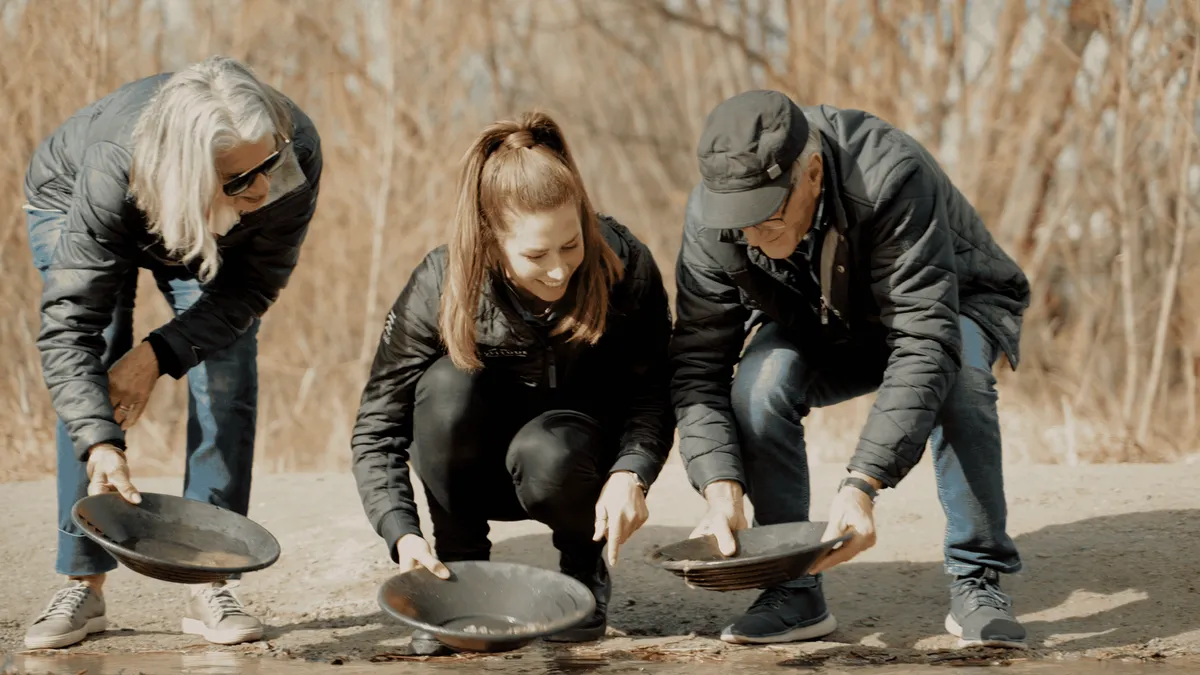
Small Group Queenstown Highlights Tour with Wine & Platters
One morning that stitches the viewpoints, Arrowtown, gold panning and a vineyard tasting with a cheese platter into a single run. Nine to one from selected hotels, small group, with coffee at Ayrburn included.
Check Availability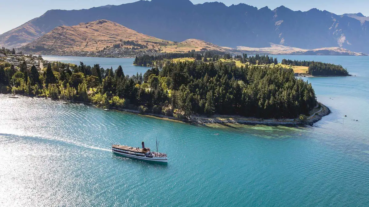 from $69.65
Queenstown: TSS Earnslaw Cruise of Lake Whakatipu
The steamer and nothing else: 90 minutes on the lake, the engine room open to walk through, the stokers feeding the coal fire in front of you. The shortest and cheapest way onto the 1912 vessel.
Check Availability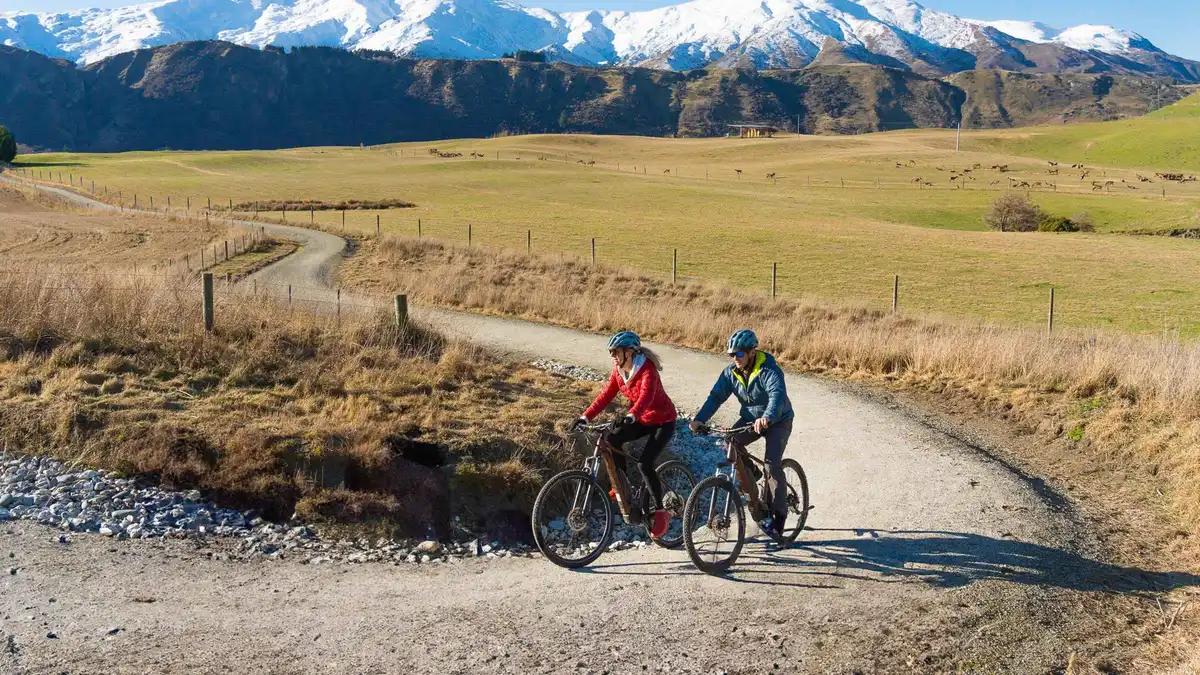 from $61.46
Queenstown: Arrowtown To Queenstown Biking Adventure
A one-way ride: the shuttle carries you and the bike out, then you pedal the 35 kilometres back along the rivers and lake edge into town. Five hours at an easy pace, standard bike or e-bike, ridden unguided.
Check Availability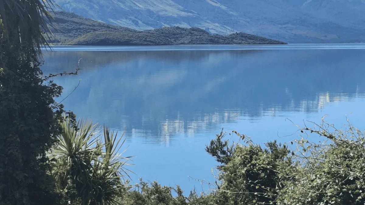 from $108.29
From Queenstown: Kayak Tour in Lake Wakatipu with pickup
A guided paddle to Pigeon or Pig Island, which this operator has exclusive landing rights to, with a short walk ashore and refreshments on a beach nobody else uses. Two and a half hours in double sea kayaks.
Check AvailabilityPrices, ratings and details are the platform's own, checked in Q3 2026; dollar figures are the listed prices — the platform bills in your account's currency.
What Counts as a Queenstown Suburb, and What Does Not
There is no council list of suburbs on any page we could open, so this section says where each name comes from and how firm it is.
Queenstown Lakes District Council does not publish a suburb list. What exists instead is a set of separate authorities that each name the same places for their own reasons, and they agree closely enough to be useful. Wikipedia keeps a category called Suburbs of Queenstown, New Zealand, and Frankton, Fernhill and Kelvin Heights all sit inside it, each with an article that calls it a suburb in the first line. Statistics New Zealand draws statistical areas over the same ground and pairs two of them: Fernhill is part of the Sunshine Bay-Fernhill statistical area, which is the formal reason those two share a guide here. The Otago Regional Council names them again as route endpoints, and that list is the practical one for a visitor, because a place that is a route terminus has a timetable and a place that is not may have nothing.
Two names in the table are not suburbs and it matters. Arrowtown is a town: it has its own Residential Historic Management Zone in the district plan, which is a planning status a suburb does not get, and the letting rules that apply to a room there are written for that zone. Arthurs Point sits outside the built-up basin on the road to the ski field, has no timing point of its own in the bus booklet, and behaves like a small settlement rather than a suburb. Both are on this page because visitors sleep in them, not because the geography says they belong.
The Names You Will See That Are Not Places to Stay
Three of the names that come up most often in a Queenstown search are retail precincts inside Frankton rather than areas of the town. Remarkables Park Town Centre is a shopping centre on Hawthorne Drive with sixty retailers and more than eight hundred parking spaces. Queenstown Central opened in 2016, covers more than 4,000 square metres and holds forty-five shops, and FiveMile sits next door to it on Grant Road.
None of them is a suburb, none of them has a residential population, and a hotel that advertises itself as being at one of them is in Frankton. Two more names belong to bus routes rather than to visitor areas: Quail Rise is the eastern end of Route 3 and Jacks Point the southern end of Route 4, and both are residential subdivisions with nothing built for a visitor to do.
The Shape of the Basin: One Arm, Two Sides and a Peninsula
Lake Wakatipu is shaped like a lightning bolt, and Queenstown sits at the one place where it bends. The town occupies Queenstown Bay on the northern shore. Immediately east of the town, a short inlet runs off the lake's northern side for about seven kilometres: that is the Frankton Arm, and it is the single feature that organises everything else. The old town is at its closed western end. Frankton is at the open eastern end, where the arm meets the main lake and drains into the Kawarau River. The Kelvin Peninsula fills the water between the arm and the main body of the lake, so a house in Kelvin Heights looks straight back across the water at the town, a kilometre and a half away, with a twenty-minute bus ride and a change between them.
Two state highways define the road network and they are both short. State Highway 6A runs seven kilometres west from Frankton to Queenstown along the northern shore of the arm; that is the road every bus, taxi and airport transfer uses, and it is the only road between the two. State Highway 6 runs east from Frankton across the flats towards Cromwell. West of the town the road narrows and climbs to Fernhill and Sunshine Bay and then stops. There is no ring road, no bypass and no second crossing of the arm: the Kawarau Falls Bridge at the far end has been foot and bike access only since 2018.
Why Frankton Gets More Sun Than the Town
This is the one piece of Queenstown geography that changes how a stay feels and almost nobody prints it. Frankton sits on the Frankton Flats, the ground bounded by the lake, the Kawarau and Shotover rivers and State Highway 6, and Wikipedia's article states plainly that the flats enjoy longer sunshine hours, particularly in winter, than the majority of land in central Queenstown, which is predominantly south facing. In the southern hemisphere a south-facing slope is the shaded one.
The town centre sits under Ben Lomond and Queenstown Hill on ground that tilts the wrong way for a July afternoon; the flats do not. If you are visiting in winter and the difference between a sunlit terrace and a shadowed street matters to you, that sentence is worth more than a rate band. What the month actually does to the light and the temperature is on Queenstown weather by month.
Five Bus Routes Are the Whole Network
Every figure in this section comes from the Otago Regional Council, which sets the fares and publishes the timetable: the route list from its Queenstown buses page and the running times from the September 2025 timetable booklet, both read in Q3 2026.
Learning the network takes about a minute, because there are five routes and they are named after their endpoints. Route 1 is the one visitors use: Sunshine Bay to Remarkables Shops, which means it runs the entire west-to-east spine through the town centre and out along the Frankton corridor. Route 2 runs Frankton Hub to Arrowtown. Route 3 runs Kelvin Heights to Quail Rise. Route 4 runs Jacks Point to Arrowtown via Queenstown, and since 30 June 2025 it also passes through Arthurs Point and along Malaghans Road in both directions. Route 5 runs Lake Hayes Estate to Queenstown.
One fare covers all of it. An adult pays $1.46 (NZ$2.50) with a Bee Card and $2.34 (NZ$4) in cash, a child or youth pays $0.88 (NZ$1.50) with a card, and the card itself costs NZ$5 with a NZ$5 minimum top-up. Tag on and off and a second bus within forty-five minutes is free, which is what makes the Kelvin Heights change bearable. There is no daily and no weekly cap: the council publishes none, so every boarding is charged in full. The full fare arithmetic, including the airport premium, is on getting around Queenstown.
| Route | Runs between | The areas it serves | Published running time |
|---|---|---|---|
| 1 | Sunshine Bay and Remarkables Shops | Sunshine Bay, Fernhill, the town centre, Frankton, the airport | Treetops to Stanley Street 12 min; Stanley Street to Frankton Hub 13 min; Frankton Hub to Stanley Street 10 min |
| 2 | Frankton Hub and Arrowtown | Frankton and Arrowtown, without entering the town centre | Frankton Hub to Adamson Drive, Arrowtown 18 min |
| 3 | Kelvin Heights and Quail Rise | Kelvin Heights and the eastern subdivisions, via the Frankton hub | Kelvin Heights to Frankton Bus Hub 20 min |
| 4 | Jacks Point and Arrowtown via Queenstown | Jacks Point, the town centre, Arthurs Point, Malaghans Road, Arrowtown | Stanley Street to Adamson Drive, Arrowtown 25 min; nothing published for the Arthurs Point stop |
| 5 | Lake Hayes Estate and Queenstown | Lake Hayes Estate, a residential subdivision with no visitor accommodation cluster | Not read for this page |
Two Things the Route Table Does Not Say Out Loud
Two things in that table are worth pulling out. The first is that Route 2 never enters the town centre, so a bus from Frankton to Arrowtown is a direct eighteen minutes while the same trip from the town centre is twenty-five on a different route. The second is the blank in the Route 4 row.
The council's own alert about the 30 June 2025 change says the Arthurs Point (Coronet Hotels) stop in the Arrowtown to Jacks Point direction does not appear in the timetable, however this bus stop will still be in use and all buses will stop there. A stop that is served but not timetabled is a stop you cannot plan a morning around.
The Ferry Is the Second Network, and Only Two Areas Are On It
Queenstown has a scheduled passenger ferry that is part of the Orbus system rather than a tour boat, and it changes the map for exactly two places. It runs between Queenstown Bay and Frankton Marina, stopping at Bayview and the Hilton, which puts Kelvin Heights and the Hilton side of the arm within one crossing of the town centre instead of two buses. Nobody publishes the crossing time, on either the operator's page or the council's.
The two things you need to know before relying on it are that it is hourly and that it stops early. Sailings leave Queenstown Bay hourly from 08:45 until 21:45, and the Hilton side hourly from 08:15 until 21:15. Miss the last one and the alternative is the long way round the arm by road, which means Route 3 and a change at Frankton, or a taxi. The fare is also the one figure on this site where two official sources disagree with each other, and the Kelvin Heights guide sets both of them out beside their sources rather than picking a winner.
Which Areas Stop Working Without a Car
Most of this basin is genuinely car-free, and that is unusual for the South Island. The town centre needs nothing but feet. Fernhill, Sunshine Bay and Frankton are all on Route 1 at fifteen-minute daytime frequencies. Arrowtown is a scheduled bus ride at the flat fare rather than a tour. Kelvin Heights works if you treat the ferry as your route home and the bus as the backup.
The honest exceptions are three. Arthurs Point has a stop but no published time, so a morning that depends on catching a particular bus from there is a morning built on nothing; the operators who work up there, including the jet boat in the Shotover canyon and the hot pools, run their own transport from town for that exact reason. Lake Hayes Estate, Jacks Point and Quail Rise are residential subdivisions at the ends of routes, with nothing built for a visitor, and staying in one means every outing is a bus ride each way. And anything beyond the basin's edge, from the ski-field roads to the gravel into Skippers Canyon, is not a bus proposition at all. What each of those journeys costs and how the region works without a car is on getting around Queenstown, and the roads that catch drivers out are set out there too.
The Walking and Riding Network Between the Areas
The Queenstown Trails Trust maintains an off-road network that links most of these areas to each other, and it is free: the Trust funds it by donation and sponsorship and publishes no ticket, pass or fee. Three of its trails do the work of a bus. The Frankton Track runs 8.5 kilometres from the Queenstown Gardens Bathhouse on Marine Parade to the Kawarau Falls Bridge, graded easy, and the Trust publishes it as 1.5 to 2 hours walking or half an hour to an hour by bike.
The Kelvin Heights Trail runs 9.3 kilometres, 2 to 3 hours on foot. The two together are published as one 16.4-kilometre ride from the Queenstown Gardens to Jardine Park. One caution for this year: major infrastructure upgrades have put a detour on the Frankton Track throughout 2026, via the sealed footpath alongside Frankton Road, and the Trust asks riders and walkers to follow the signage and share the route with road traffic.
More of the walking network is on the Queenstown walks page.
Where Locals Live, and What That Does to a Visitor
The figures below are Statistics New Zealand's, reported through each area's Wikipedia article: subnational population estimates as at June 2025 and the 2018 census for the demographic detail. They are the closest thing to an answer to a question the search results ask constantly.
Two of the areas on this page hold most of Queenstown's residents, and they could not feel less alike. Frankton covers 7.56 square kilometres and had an estimated population of 3,990 in June 2025, a density of 528 people per square kilometre. Its median age at the 2018 census was 32.8 years against 37.4 nationally, and 49.7 per cent of its residents were born overseas against 27.1 per cent nationally. That is a young, international, working suburb, and it explains the shape of what is there: three retail precincts, a hospital, an events centre with a swimming pool, and the schools.
Kelvin Heights is the opposite reading. It covers 9.28 square kilometres with an estimated 1,220 residents in June 2025, a density of 131 per square kilometre. Its median age was 43.4 and 19.5 per cent of residents were 65 or older. The New Zealand Herald reported in 2007 that it had become the country's first suburb with a median house value of about a million dollars, in 2005. A visitor feels all of that as quiet: no late kitchens, no shops open at nine at night, and a bus that goes to the hub rather than the town.
The practical consequence is simple enough to state. The suburbs where people live are the ones with supermarkets, doctors and schools, and they are cheaper to sleep in; the area where visitors are the population is the one with the late food and the check-in desks, and it costs more. Which of those trades is right for your trip is exactly the question where to stay in Queenstown prices out area by area.
Picking an Area, in One Sentence Each
If the geography above has not settled it, here is the compressed version, and every one of these sends you to the page that argues it properly.
- Stay in the town centre if the trip is two or three nights, you have no car, and you want to walk home from dinner rather than watch a clock. - Stay in Frankton if you have an early flight, a hire car, a family that needs a supermarket, or a budget that wants the narrowest price band in the basin. - Stay in Fernhill or Sunshine Bay if a lake view for less matters more than a five-minute walk to food, and you will genuinely ride the bus in and out. - Stay in Kelvin Heights if the ferry appeals as a daily habit, you play golf, or you would rather look at the town than stand in it. - Stay in Arthurs Point if you are driving, and in Arrowtown if you want a separate town with a museum, a main street and an autumn worth planning around.
Whatever you pick, the activities are mostly booked centrally and the operators come to you or meet you in town, which is why the area decides your evenings far more than it decides your days. The full catalogue of what those days can be is on things to do in Queenstown.
The Queenstown Suburbs on the Map
Blue pins are the areas with a guide of their own on this site, green pins the two that sit outside the built-up basin and behave differently. The popups carry the council's scheduled bus minutes into the town centre where one is published.
Pin positions are the area centres used across this site's maps; bus minutes are the Otago Regional Council's scheduled times between timing points, read in Q3 2026.
Where to Go From the Map
Three pages that take this geography and turn it into a decision.
The price question, area by area
The same areas priced against each other on nightly rate bands, sample sizes and council letting rules: where to stay in Queenstown.
Six bands, one October nightFares, the ferry and parking
The full fare table, the Bee Card arithmetic, the ferry timetable and where a hire car can actually be left: getting around Queenstown.
$1.46 (NZ$2.50) a rideArriving, and the eight kilometres from the runway
What the transfer from the terminal in Frankton costs by bus, taxi and shuttle: Queenstown airport to town.
Route 1, or a taxiQueenstown Suburbs: Questions
What are the suburbs of Queenstown?
The ones a visitor meets are the town centre, Frankton, Fernhill, Sunshine Bay and Kelvin Heights, all of which sit in Wikipedia's Suburbs of Queenstown, New Zealand category and each of which is described as a suburb in its own article. Arthurs Point is a settlement up the Shotover rather than a suburb, and Arrowtown is a separate town with its own historic zone in the district plan. Queenstown Lakes District Council publishes no suburb list of its own on any page we could open, so there is no single official roll to quote. The seven are set out with their bus routes in the area table.
Where do locals live in Queenstown?
Mostly in Frankton and the subdivisions east of it. Statistics New Zealand estimated Frankton's population at 3,990 in June 2025 across 7.56 square kilometres, against 1,220 in Kelvin Heights, and Frankton's 2018 median age of 32.8 years was five years below the national figure. That is where the supermarkets, the hospital, the events centre and the three schools are, and it is the reason the Frankton guide reads like a working suburb rather than a resort. The town centre itself has residents, but on any given night the visitors outnumber them.
Which areas of Queenstown need a car?
Only one of the seven really does. Arthurs Point is served by Route 4 in both directions, but the Otago Regional Council publishes no timing point for it, so no scheduled minutes exist to plan against; the operators up there run their own transport instead, which is how the hot pools and the canyon jet boat get their guests. Everywhere else on this page has a published running time and a flat $1.46 (NZ$2.50) fare. Beyond the basin, the ski-field access roads and the gravel into Skippers Canyon are not bus propositions at all.
How far apart are the areas of Queenstown?
Closer than the map makes them look. The whole basin fits inside twenty-five scheduled bus minutes of the Stanley Street hub: Fernhill is twelve, Frankton thirteen, Kelvin Heights twenty to the Frankton hub and then a change, and Arrowtown twenty-five. On foot, the Queenstown Gardens to the Kawarau Falls Bridge is 8.5 kilometres and 1.5 to 2 hours by the Queenstown Trails Trust's own figures. The one gap between areas that is water rather than road is the Frankton Arm, and the ferry crosses it hourly.
Is there an area of Queenstown with no bus service at all?
Not among the seven here, though Arthurs Point comes close in practice: a stop that is served but carries no published time is a stop you cannot build a schedule on. What genuinely has no service is everything outside the basin edge, including the roads up to the ski fields and the route into Skippers. The council's five routes are set out in the route table above, and the fares and last departures are on getting around Queenstown.
What towns are near Queenstown?
Arrowtown is the nearest, twenty-five scheduled minutes away on Route 4 and reachable on an ordinary bus fare. Beyond that the neighbours are an hour or more by road: Wanaka over the Crown Range, Cromwell east down the Kawarau Gorge, and Glenorchy at the head of the lake on a road that ends there. None of them is on the Orbus network, so all three are a hire car or a booked trip. The full set of what is a day out rather than a base is on day trips from Queenstown.
The Queenstown Suburbs on Video
Three drives through areas this page describes, chosen because they show the ground rather than the postcard: what the streets, the gradients and the distances between the areas actually look like.
Jack's Point: A Luxury Suburb in Central Otago, Queenstown
The southern end of Route 4, and a good look at what a Queenstown residential subdivision is and is not.
Video: Driving and FilmingArthurs Point, a Queenstown Suburb in New Zealand: 4K Driving Tour
The settlement above the Shotover Gorge, and the road that explains why no scheduled bus time is published for it.
Video: Walk n RollShotover Country, a Kiwi-Style Residential Neighbourhood, New Zealand
One of the newer subdivisions on the flats east of Frankton, filmed at street level.
Video: Walk n RollVideos load from YouTube only when you press play.
Reviewed Q3 2026 (July–September 2026); next review Q4 2026. Prices, hours and terms are set by the venue or operator and confirmed at checkout.
We may earn a commission if you book through one of our links, at no extra cost to you. Full affiliate disclosure