 Queenstown City Guide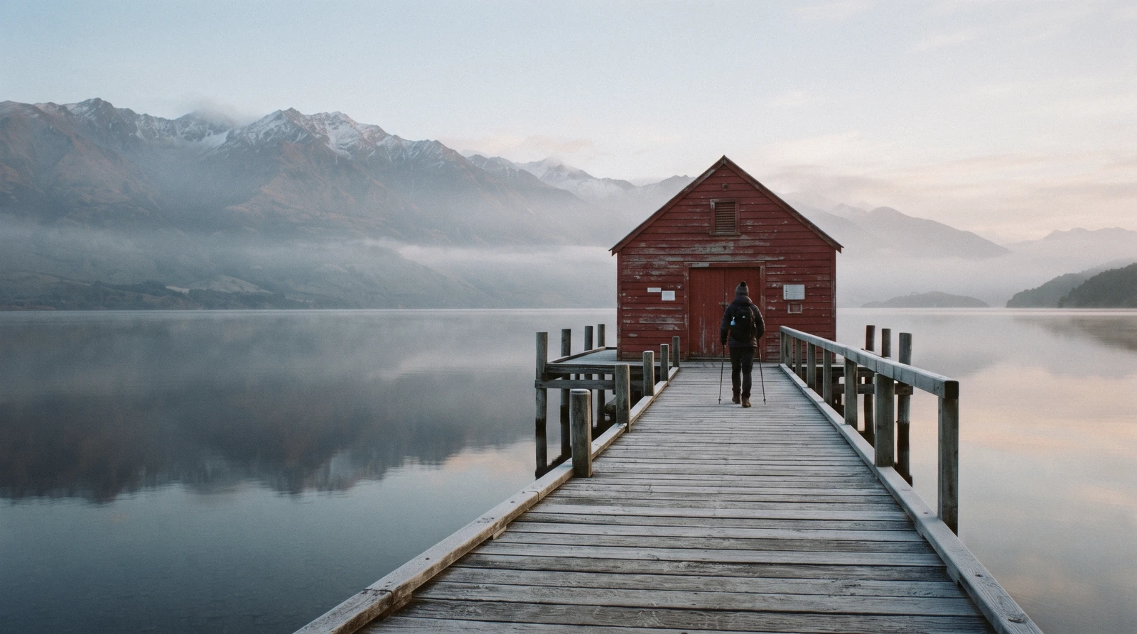
Glenorchy, New Zealand
Glenorchy, New Zealand sits at the head of Lake Wakatipu, and the road that gets there is the reason to go. The Glenorchy-Queenstown Road runs the western shore past Twelve Mile Delta, Bob's Cove and Bennetts Bluff before the mountains open out; beyond the township the gravel carries on to Paradise, the Dart and Rees valleys and the Routeburn Shelter. This page sets out which of the film locations you can stand in for nothing and which need a paid seat, what the Department of Conservation publishes about the walks and the Great Walk that starts here, and the figures nobody publishes at all. It belongs to the day trips hub; driving and shuttle options are on getting around Queenstown. The road out here is one of five days the independent Queenstown guide maps out.
Quick answer What the drive is, what it costs, which film locations are free
Glenorchy is a settlement of about 360 people at the head of Lake Wakatipu, and the whole of it is free: no gate, no ticket, no hours. DOC publishes 14 km from Queenstown to the Bob's Cove car park on this road and 68 km from Queenstown to the Rees trailhead beyond Glenorchy, which brackets the drive, but no roading authority publishes a Queenstown to Glenorchy figure at all.
Key takeaways
- The lookouts, the red wharf shed, the lagoon boardwalk and the road to Paradise cost nothing, so the only reason to buy a seat is the commentary and the private-land stops on a Lord of the Rings day to Glenorchy or the half-day with the original call sheets.
- Paradise is 12 km north of Glenorchy on gravel, per the council's own hearing report, and DOC asks drivers not to park on that road near the walkway because it is a crash hot spot.
- The Routeburn starts 25 km beyond the township, and walking any section as a day walk is free: the fee is for a bunk or a tent site, not for the track.
- There is no fuel and no mobile coverage past the township, so fill up in Queenstown; getting around Queenstown covers rentals and shuttles.
Key facts
Opening hours
| Daily, all year (open access, no gate) | 00:00–23:59 |
|---|
Closed None. Glenorchy has no opening hours; the constraints are daylight, weather and the state of the gravel beyond the township
Admission
- Adult
- Free. DOC charges nothing for the Glenorchy Walkway, the lagoon boardwalk, the Bennetts Bluff viewpoint walk or the drive to Paradise
- Reduced
- Guided film-location days from Queenstown are listed at $116.48 and $122.33 on GetYourGuide
- Free
- Every walk, viewpoint and public road in the Glenorchy area, and any section of the Routeburn walked as a day walk
Planning it
- Time needed
- Not stated by DOC. Our routing: 4 hours for the road, the wharf and the township; 7 to 8 hours to add Paradise and the Routeburn Shelter
- Book ahead
- Optional — walk-up usually fine
- Address
- Glenorchy, head of Lake Wakatipu, reached by the Glenorchy-Queenstown Road; the Glenorchy Walkway starts at the northern end of the township, signposted near the lake on Mull Street
Four ways to see the head of Lake Wakatipu, read from doc.govt.nz and the GetYourGuide listings on in Q3 2026. Prices on this site are United States dollars first with New Zealand dollars in brackets at NZ$1 = $0.584; the two tour cards are listed in US dollars by the platform. The first row is the conservation authority and its link carries no tracking.
Are you paying to get in, or paying for private land and commentary? Nothing at the head of the lake charges admission, so the only question is whether you want a guide and a vehicle.
| Option | Price | What it covers | Cancel | Book |
|---|---|---|---|---|
| Drive it yourself, DOC area pageAnyone with a car and a morning. The honest default, and it costs nothing | Free | The Glenorchy Walkway and lagoon boardwalk, Diamond Creek Walk, the Bennetts Bluff viewpoint walk, the wharf and the road to Paradise | Nothing to cancel; the road is the only thing that closes | Official site |
| Routeburn hut or campsite, booked with DOCTrampers walking the Great Walk. Day walkers need none of it | Hut $77.10 (NZ$132) international adult in season; campsite $24.50 (NZ$42) | A bunk or tent site in Mount Aspiring and Fiordland national parks; the track itself is free to walk | DOC booking terms; residency is checked at visitor centres and huts | Official site |
| Lord of the Rings day to Glenorchy, with pickupFilm-first visitors without a car who want the drive done for them | $122.33 | The Glenorchy Road, the Dart Valley and Diamond Lake, park fees, hot drink, costumes and replica swords | Free up to 24 hours before the start time | Check Availability |
| Lord of the Rings locations half-day, meeting in townAnyone who wants the production paperwork rather than the longer valley drive | $116.48 | Locations around Queenstown and towards Glenorchy, original scripts and call sheets, licensed replica props | Free up to 24 hours before the start time | Check Availability |
The ratings do not separate them: both sit at 4.9, one from 507 reviews and one from 217. The route does. The Pure Glenorchy day offers hotel pickup and goes further up the valley; the Southern Trails half-day meets at 43 Camp Street and leans on the archive material. Neither replaces the drive if you have a car.
Glenorchy and Lord of the Rings tours compared
Two film-location days, both rated 4.9, both four and a half hours, both listed in US dollars on GetYourGuide as read on in Q3 2026. Prices, ratings and durations are the operator's own and are confirmed at checkout.
 from $122.33
Most booked
from $122.33
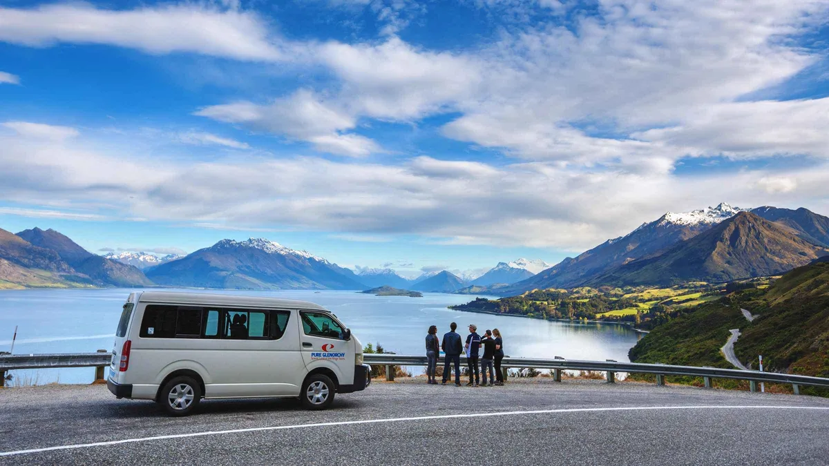
Most booked From Queenstown: Lord Of The Rings Tour to Glenorchy
Follows the Glenorchy Road to the Dart Valley and Diamond Lake, with national park fees and a hot drink covered, plus costumes and replica swords to handle. Four and a half hours, small group, pickup included.
Check Availability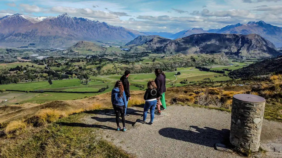 from $116.48
Queenstown: Lord of the Rings Locations Half-Day Tour
Film locations with the paperwork attached: original scripts and production call sheets to read, and licensed replica weapons to photograph. Four and a half hours by minibus, meeting on Camp Street rather than a pickup.
Check AvailabilityPrices, ratings and details are the platform's own, checked in Q3 2026; dollar figures are the listed prices — the platform bills in your account's currency.
The Glenorchy-Queenstown Road: what is published and what is not
The most useful thing on this page is a thing nobody states. The road is the attraction, and no authority publishes its length or its driving time.
The Glenorchy-Queenstown Road is a local road, which puts it under Queenstown Lakes District Council rather than the state highway network, and neither the council nor the Department of Conservation publishes a Queenstown to Glenorchy distance or drive time on any page we could read. What DOC does publish are distances to individual car parks along it, and those bracket the journey from both ends. The regional tourism organisation, queenstownnz.co.nz, calls it "a spectacular 45-minute drive northwest from Queenstown" across four of its articles, and Wikipedia gives roughly 45 km by road; neither is a roading authority, so those go in as attributed claims and DOC's figures go in as facts.
| Published point on the road | Distance | Who publishes it | What it tells you |
|---|---|---|---|
| Bob's Cove Track car park | 14 km from Queenstown | DOC, Queenstown area track page | The first proper stop, and the only Queenstown-referenced distance DOC gives on this road |
| Whakaari Conservation Area car park | 3 km before Glenorchy | DOC, Head of Lake Wakatipu brochure | The scheelite mine tracks; you are almost there when you pass it |
| Routeburn Shelter | 25 km from Glenorchy, partly unsealed | DOC, Routeburn Track page | The Great Walk trailhead, and the furthest most day visitors drive |
| Muddy Creek car park, Rees Track | 68 km from Queenstown via Glenorchy | DOC, Rees-Dart Track page | Glenorchy sits well inside this, the tightest official bracket available |
| Dart Track start | 76 km from Queenstown via Glenorchy | DOC, Rees-Dart Track page | The far end of the valley road, gravel for the last stretch |
What the road is actually like
Sealed as far as Glenorchy and a short way beyond, then gravel into the valleys. Two lanes, no passing lanes, drop-offs on the water side, and laybys rather than car parks at the viewpoints, which is why they fill and why people stop in bad places. DOC campsites at Twelve Mile Delta and Moke Lake are signposted off it.
DOC's one explicit instruction on this road concerns the far end: do not park at or access the Glenorchy Walkway from the Glenorchy-Paradise Road, which "is a hot spot for accidents". Use the signposted Mull Street start. Mobile coverage exists in the township and nowhere else on the route, and no official source lists a fuel stop between Queenstown and the head of the lake.
How much time to give Glenorchy
DOC publishes no suggested visit length for the Glenorchy area, so the three routings below are ours, built from its published walk times and the distances above.
The mistake is treating this as a photo stop. People drive out, take the wharf picture and drive back having seen a car park; the valley beyond the township is where the scale is.
| Routing | Door to door | What you get | What it skips |
|---|---|---|---|
| Short: the road and the wharf | About 4 hours | Bob's Cove, Bennetts Bluff, the red shed on the wharf, coffee in the township | Paradise, the Routeburn Shelter, the lagoon boardwalk |
| Full: the road, the walkway and Paradise | 7 to 8 hours | All of the above plus the 1 to 2 hour Glenorchy Walkway over the wetland and the gravel run to Paradise and the Routeburn Shelter | The Rees and Dart trailheads, another hour of gravel each way |
| With a tour | 4 hours 30 minutes | The film stops with commentary, park fees and props included, and no driving | The pace is theirs; neither itinerary reaches the boardwalk or the Routeburn Shelter |
The half-day trap, and one contradiction on the listing
Both film tours run four and a half hours, the same as our short routing but with a guide instead of lookout stops of your own choosing. If the films are the reason you are going, take that trade; if the mountains are, drive, because the extra three hours buy Paradise, the Routeburn Shelter and a boardwalk no tour on this page visits.
One data note. The half-day film tour is listed at four and a half hours, while its own difficulty line describes "a 9 to 13 hour day with several stops". Both cannot be true. We print the stated duration and flag the contradiction rather than choosing; confirm the finish time at checkout.
Film locations: what a public road reaches, and what it does not
The honest version of the Middle-earth question. Some of what was filmed here is standing on a road verge; some is on private land or deep in a national park, where a seat on a tour is the only realistic way in.
Wikipedia's Glenorchy article records that scenes for The Fellowship of the Ring (2001) were shot at nearby Paradise, naming Lothlorien, Orthanc and the scene in which Boromir is killed. Vertical Limit (2000), The Chronicles of Narnia: Prince Caspian (2008) and X-Men Origins: Wolverine (2009) also used the area, and the 2013 BBC series Top of the Lake was set around Paradise with Glenorchy standing in for the fictional town of Laketop.
The two tourism bodies disagree about what the Paradise beech forest was. Tourism New Zealand's Glenorchy page says "the forested area near Paradise was used for the gardens of Isengard". The regional tourism organisation says "the native beech forests in Paradise were the setting for the enchanted forest realm of Lothlorien". Two official tourism sources for the same country, two different locations for the same forest, neither citing the production. Treat any single confident claim about which tree was which accordingly.
- Free from the public road: the lake views, Bennetts Bluff, the Dart River flats and the drive through Paradise, a locality rather than a gated site
- Free but a walk: the Glenorchy Walkway wetland and the Routeburn forest at the end of the sealed road
- Needs a seat: the private-property stops, the costumes, the replica weapons and the production call sheets
- Needs a different budget: the backcountry locations up the Dart and Rees, reached by jet boat, horse or helicopter
What a tour adds that the road cannot
Two things, worth naming precisely because everything else is free. The Glenorchy day includes national park fees, a hot drink, and costumes and licensed replica steel swords to handle, and offers hotel pickup so nobody drives the gravel. The half-day carries original scripts and production call sheets and licensed replica props, and meets at 43 Camp Street rather than collecting you.
What neither adds is access to a location you could not photograph from a road, apart from the private-property stops each operator arranges. If a specific frame is the object, ask which stops are on private land before booking.
Glenorchy in eight dates
The head of the lake was a seasonal Maori destination for centuries before it was a farm, a goldfield or a film set, and it had no road at all until living memory.
-
Before European settlement
A summer route for pounamu and moa
Kai Tahu, Kati Mamoe and Waitaha travelled to the head of the lake to hunt and to take pounamu from the mountains to the west. DOC records about 30 summer campsites here.
-
1853
Nathaniel Chalmers reaches the lake
Guided by Reko and Kaikoura, Chalmers becomes the first European to see Lake Whakatipu (Lakes District Museum district timeline).
-
1860
William Rees settles the head of the lake
Rees crossed the Crown Range from Cardrona and took up the run; DOC dates his settlement of the head of the lake to 1860.
-
1862
Gold reaches the head of the lake
The Whakatipu rush begins in the Arrow and Shotover rivers; DOC dates gold here to the same year. The Arrow River end of the story is on the Arrowtown page.
-
1882
Commercial guiding begins on Mount Earnslaw
DOC records commercial mountain guiding starting on Mt Earnslaw / Pikirakatahi, making this one of New Zealand's oldest guided-mountain destinations.
-
1884 to 1911
Schools follow the settlers
The first school opened at Kinloch in 1884, another in 1888 on the road to Paradise; the present school opened near Buckleburn in 1911 and moved site in 1939.
-
1962 and 1964
The road opens, then the national park
Until 1962 visitors came by boat, including on the TSS Earnslaw, and by pack track. Mount Aspiring National Park was formed two years after the road opened.
-
25 February 2025
Tahuna Glenorchy Dark Sky Sanctuary certified
DarkSky International announced the certification, after five years of work by the Glenorchy Heritage and Museum Group.
Sources: the Department of Conservation's Glenorchy area page and the Lakes District Museum's district timeline, both read on in Q3 2026, plus the Glenorchy article on English Wikipedia citing DarkSky International.
The walks at the head of the lake, and the one you should not park for
Everything DOC maintains here is free and none of it needs booking. What matters before you set out is where the walkway starts and where you must not stop.
The Glenorchy Walkway is the one to do if you do only one: a boardwalk over the wetland at the northern end of the township, graded easy to intermediate by DOC, one to two hours, and described by DOC as great for children. Follow the signs near Lake Wakatipu on Mull Street. The lagoon holds pied stilt / poaka, Australasian bittern / matuku-hurepo, New Zealand shoveller / kuruwhengu and scaup / papango among others, with karearea overhead.
In heavy or prolonged rain the lagoon section floods, which is DOC's own wording. Dogs on a leash are allowed on the Glenorchy Walkway, the Diamond Creek Walk and the Bennetts Bluff viewpoint walk, but dogs are banned in Mount Aspiring National Park, the Routeburn Shelter included. Mountain bikes are not allowed on any of these walks.
- Glenorchy Walkway: 1 to 2 hours, easy to intermediate, boardwalk and wetland, starts on Mull Street
- Diamond Creek Walk: a trout-fishing creek towards Lake Reid, Paradise and the Dart valley
- Bennetts Bluff viewpoint walk: the first full view of the head of the lake
- Lake Sylvan: car park 30 minutes from Glenorchy on gravel (DOC brochure)
- Whakaari Conservation Area: scheelite mine tracks, car park 3 km before Glenorchy
The lake is not for swimming here
DOC is blunt about the head of the lake: it "is a challenging place for swimming and can be dangerous. There are strong currents where the river meets the lake, and the lake is very cold." No official source publishes a water temperature for Lake Wakatipu and none publishes a drowning count for it, so we print the warning rather than a number. The lake's other oddities are on the Lake Wakatipu page.
The Routeburn Shelter: the Great Walk that starts here
Glenorchy's other identity is as a trailhead. The Routeburn is a Great Walk and its northern end sits 25 km beyond the township, which makes the shelter a legitimate afternoon drive even if you are not walking it.
DOC states the shelter is 25 km from Glenorchy along a partially unsealed road, and that the other end, The Divide on State Highway 94, is 85 km from Te Anau. The number that surprises people is the third: the road distance between the two ends is 325 km, which is why every through-walker books transport at both ends. The track is 33 km one way, two to four days, most walkers taking three days and two nights at the Routeburn Falls and Lake Mackenzie huts.
The fee catches day visitors out in the opposite direction to what they expect. There is no track pass and no charge to walk any section as a day walk; what you pay for is a bunk or a tent site. Great Walks pricing splits New Zealand residents from international visitors, with random residency checks at visitor centres and huts.
| Booking | International adult | International child | NZ resident adult | When it applies |
|---|---|---|---|---|
| Hut, Great Walks season | $77.10 (NZ$132) | $38.50 (NZ$66) | $51.40 (NZ$88) | October to April; booking required |
| Campsite, Great Walks season | $24.50 (NZ$42) | $12.26 (NZ$21) | $16.35 (NZ$28) | October to April; booking required |
| Hut, May and June | $20.40 (NZ$35) | $10.22 (NZ$17.50) | $20.40 (NZ$35) | Shoulder rate, no residency split |
| Hut, July and August | $17.52 (NZ$30) | $8.76 (NZ$15) | $17.52 (NZ$30) | Winter rate; facilities greatly reduced |
| Any section as a day walk | Free | Free | Free | All year, in weather you are equipped for |
Season, and the category change that goes with it
The 2026/27 Great Walks season runs 1 November 2026 to 30 April 2027 and bookings are open. In that window the Routeburn is an intermediate tramping track and huts must be booked well in advance; outside it, from 1 May to 31 October 2026, DOC reclassifies the same ground as advanced and expert and says to attempt it only with alpine, river-crossing and navigation skills. From the shelter the first section to Routeburn Flats Hut is 7.5 km, which DOC times at 1 hr 30 min to 2 hr 30 min one way, so an out-and-back is a real afternoon.
DOC does not publish how quickly the Routeburn sells out, the one figure every planning question asks for; we chased it across the track page and the pricing page and found only the instruction to book well in advance. Two details change a day walk: Harris Saddle / Tarahaka Whakatipu is the high point at 1,255 m and its shelter is day-use only, and Lake Howden Hut was destroyed by storm damage in February 2020 and has not been replaced. The wider walking picture is on the Queenstown walks hub.
Paradise: where it is, what it is not
Paradise is the name that sells the drive and the one nobody defines. It is a rural locality: not a village, not a park, not a viewpoint with a sign.
Neither DOC nor the district council publishes a visitor page for Paradise. The one council-published figure we located sits in a Queenstown Lakes District Council district plan hearing report, which places a submission site "on the Glenorchy Paradise Rd, 12 kilometres north of Glenorchy". What is there is beech forest, the Dart River flats and the view up the valley.
The scale is best read from the census geography. Stats NZ's Glenorchy statistical area includes Paradise, covers 1,464 square kilometres and was estimated at about 520 people in June 2025; the settlement itself was estimated at about 360. Tourism New Zealand's Glenorchy page describes "this small community of just 500 residents", which is the statistical area rather than the township.
- The road to Paradise is gravel and public; DOC's Diamond Lake Campsite sits on the way, at the edge of Mount Aspiring National Park
- There is no Paradise settlement to walk around, no shop and no fuel
- DOC's safety line applies here above all: do not park on the Glenorchy-Paradise Road to reach the walkway
- Accommodation in the area is off-grid; treat it as a booked stay rather than somewhere to turn up
What goes wrong on this drive
Nothing at the head of the lake closes on a day of the week. What closes it is water, ice and daylight.
Queenstown has no dry season: every month of the ERA5 reanalysis for 1995 to 2024 averages between 93 mm and 141 mm of rain, September and October wettest, July and August driest. That bites here in three ways. The lagoon section of the walkway floods in heavy or prolonged rain, in DOC's own words. The gravel beyond the township deteriorates fastest in the same conditions, and a rental agreement may exclude unsealed roads. And winter shortens the usable day badly at 45 degrees south: in July the valley averages a daily maximum of 4.4 degrees Celsius and a minimum of 0.0.
Neither operator publishes a weather-cancellation cutoff. Both listings state free cancellation up to 24 hours before the start time; neither says what happens if the operator cancels on the morning, or at what wind or rainfall the day is called off. We looked on both and found no threshold, so plan a spare day rather than a refund policy. The year-round picture is on best time to visit Queenstown and the wet-day alternatives on rainy day in Queenstown.
Glenorchy: what to do and what to avoid
Six decisions you can make before you turn the key, each argued somewhere above.
Do this
- Leave Queenstown with a full tank and your map downloaded; DOC states coverage exists only in the township
- Start before 09:00 if the lookouts matter, because the film tours and coaches run the road late morning
- Give the full routing 7 to 8 hours if you want Paradise and the Routeburn Shelter as well as the wharf
- Park for the walkway at the signposted Mull Street start at the northern end of the township
- Check your rental agreement for unsealed-road cover before driving to Paradise
Not this
- Do not park on or reach the walkway from the Glenorchy-Paradise Road; DOC calls it a hot spot for accidents
- Do not treat the tourism board's 45 minutes as a schedule, since no roading authority publishes a drive time
- Do not swim at the head of the lake, where DOC warns of strong currents and very cold water
- Do not book a tour expecting access you cannot get yourself; ask which stops are on private land first
- Do not plan the Routeburn casually outside 1 November to 30 April, when DOC grades it advanced to expert
Every item comes from DOC's Glenorchy area and Routeburn pages or from the operator listings, read on in Q3 2026.
Five things most visitors do not know about Glenorchy
Each of these came out of an official page or a public record rather than a travel article, and each carries its source.
- There was no road here until 1962; before that everyone came by boat, including on the TSS Earnslaw, or on pack tracks (Department of Conservation, Glenorchy area page; Lakes District Museum district timeline)
- The whole area is a certified dark sky sanctuary, announced by DarkSky International on 25 February 2025 after five years of work by the Glenorchy Heritage and Museum Group (English Wikipedia, Glenorchy article, citing DarkSky International)
- Blanket Bay south of the township is named for nineteenth-century shearers who sheltered in tents made from blankets, and holds the settlement's airstrip, managed by Queenstown Airport Corporation with two helipads (English Wikipedia, Glenorchy article)
- Glenorchy School had a roll of 29 as of July 2026, the clearest single measure of how small the permanent community is (Education Counts roll data, via the Glenorchy article on English Wikipedia)
- The Routeburn links with the Greenstone and Caples Tracks into a circuit starting and finishing near the Routeburn Shelter, so the trailhead is the start of several trips rather than one (Department of Conservation, Routeburn Track page)
The Glenorchy Road on a map: the stops, in order
Coordinates are LINZ New Zealand Gazetteer points, except Glenorchy township and the Routeburn Shelter, which are approximate. Distances in the notes are DOC's own.
Points from the LINZ New Zealand Gazetteer, read on in Q3 2026.
What pairs with the Glenorchy road, and what does not
The head of the lake is a dead end, so nothing pairs with it on the same road. These are the three trips for the days either side.
Lake Wakatipu
The lake you spend three hours beside has its own page: the S shape, the rise and fall the brochures misdate, and why DOC calls the head of it dangerous for swimming are on the Lake Wakatipu page.
The whole drive is along itArrowtown
The opposite kind of day and the other half of the 1862 gold story: a walkable historic street, a museum with published hours and a bus that goes there. Arrowtown is the answer when the gravel is not appealing.
20 km north of Queenstown, the other directionDay trips from Queenstown
Milford Sound, Wanaka, Mount Cook and the rest, with the drive times that decide which fit the days you have. The day trips hub compares them side by side.
Every other directionGlenorchy questions
How far is Glenorchy from Queenstown?
No roading authority publishes the figure. Queenstown Lakes District Council is the road controlling authority for the Glenorchy-Queenstown Road and states no distance or drive time on any page we could read, and DOC does not either. DOC's published points bracket it: the Bob's Cove Track car park on this road is 14 km from Queenstown, and the Rees trailhead beyond Glenorchy is 68 km from Queenstown via Glenorchy. The regional tourism organisation calls it a 45-minute drive and Wikipedia gives roughly 45 km by road; neither is an authority. The road section lists every published point.
What is Glenorchy famous for?
Three things. The film locations shot around it and at nearby Paradise, including scenes from The Fellowship of the Ring; the Routeburn Track, whose northern trailhead is 25 km past the township; and the drive itself, which is why people who arrive expecting a village leave talking about a road. It is also a certified dark sky sanctuary, announced in February 2025.
What was filmed in Glenorchy?
The Fellowship of the Ring (2001) used nearby Paradise, with Lothlorien, Orthanc and Boromir's death among the sequences shot there. Vertical Limit (2000), The Chronicles of Narnia: Prince Caspian (2008) and X-Men Origins: Wolverine (2009) also filmed in the area, and the 2013 BBC series Top of the Lake used Glenorchy as the fictional town of Laketop. The two national tourism bodies disagree about whether the Paradise beech forest was Lothlorien or the gardens of Isengard, which the film section sets out.
Is the drive from Queenstown to Glenorchy easy?
The sealed section to the township is straightforward in daylight: two lanes, no passing lanes, drop-offs on the lake side, laybys rather than car parks at the viewpoints. Beyond the township it turns to gravel, and many rental agreements exclude unsealed roads. DOC's one explicit safety instruction here is not to park at or access the walkway from the Glenorchy-Paradise Road, which it calls a hot spot for accidents. If you would rather not drive, both film-location days include the transport.
How many people live in Glenorchy, New Zealand?
Stats NZ classes Glenorchy a rural settlement and estimated it at about 360 people as at June 2025. The wider Glenorchy statistical area, which takes in Paradise across 1,464 square kilometres, was estimated at about 520. Tourism New Zealand's page says "just 500 residents", which is the statistical area rather than the township. Stats NZ publishes place summaries through a tool that returned nothing to an automated read on in Q3 2026, so both figures here are its subnational estimates rather than a census count.
Can you walk part of the Routeburn Track as a day walk from Glenorchy?
Yes, and it costs nothing: there is no track pass, and DOC's fee is for a bunk or a tent site only. From the Routeburn Shelter the first section to Routeburn Flats Hut is 7.5 km and DOC gives 1 hr 30 min to 2 hr 30 min one way, which makes an out-and-back a genuine afternoon. Outside 1 November to 30 April DOC grades the track advanced to expert, so the season note matters before you set off.
Our verdict on the Glenorchy day
Drive it, and give it the full day rather than the half. The stops that make this trip are the ones no tour can sell you: a layby above the lake with nobody in it, the boardwalk over the lagoon, and the gravel run to Paradise and the Routeburn Shelter where the valley finally opens. All of it is free, and the equipment it needs is a full tank and an offline map.
Buy a seat in one situation: you want the film material and you do not want to drive, in which case the Glenorchy day with pickup goes furthest up the valley and the half-day from Camp Street is the one with the original scripts and call sheets. Take the clear day for the head of the lake and put the wet one into Arrowtown or the rest of the day trips.
The Glenorchy Road on Film: the Drive, the Wharf and Paradise
Three films that answer what a page cannot: how the road looks from the driver's seat, what the wharf and the red shed are really like, and how far the gravel to Paradise goes.
Most Magical Place In New Zealand | Queenstown To Glenorchy | EP2
The drive filmed end to end, which is the part this page argues is the attraction.
Video: HojaeThe Road to Paradise (glenorchy, new zealand)
What the gravel north of the township is like, and what Paradise turns out to be.
Video: Nick & RaychelGlenorchy : Town in the South Island | Glenorchy Wharf | otago | New Zealand
The township and the wharf at ground level, including the red shed everyone photographs.
Video: Driving and FilmingVideos load from YouTube only when you press play.
Reviewed Q3 2026 (July–September 2026); next review Q4 2026. Prices, hours and terms are set by the venue or operator and confirmed at checkout.
We may earn a commission if you book through one of our links, at no extra cost to you. Full affiliate disclosure